
Community Centre
Lower Donlands, Toronto ON
The Gathering Place (Maamiginan) is reflective on the past’s natural marshland and historic seasonal settlements of the Mississauga people where they have referred to this land as “sticks coming out of water”. Incorporating the Medicine Wheel gives focus on the natural elements and human relationship that represent the circle of life. The Gathering Place provides Indigenous and community users a space where they can meet, learn and engage. The connection to land and water is interdependent with the overall form and programming.
The community centre fosters program to build better relationship and understanding between Indigenous and non-Indigenous users through the act of gathering. The constant motion and tribute to land creates moments of reflection and contemplation. Providing private and public spaces will foster social interaction and local traditions that is brought forth in this waterfront community. The Gathering Place allows users to understand, value and acknowledge the local cultural significance.

MAAMIGINAN

Keating Channel

REGIONAL SIGNIFICANCE
marshland
"sticks coming out of water"
gathering spot along Lake Ontario and Don River
seasonal settlements

Proposed Development by Michael Van Valkenburgh Associates Inc “Port Lands Estuary”

Site Diagrams
1824
2017
The Don River has its geographic importance in the city and is 38 km in length that flows south to Lake Ontario from the East and West Don Rivers. It dates back to 12,000 years ago when it was first used by the First Nation peoples and later the European explorers. Before the straightening of the Don River in the 19th and 20th century, the river used to lead to one of the largest marshlands in Lake Ontario before it dried up. What used to be the natural marshland is now the Lower Donlands. According to history of the First Nations settlement in Toronto, the area by the Lower Donlands was described as sticks coming out of the water and was a meeting place.
From 1870, breakwaters, channels and man-made structures were developed to lessen the problem posed by the marshes and river that affected the urban settlement of York. Additional alterations were made to the Lower Donlands 1824 in 1910s which introduced the Keating Channel in 1914 and the infilling of the marshes. 400 hectares of land has been developed in the marshes which created a rectilinear borderline.
In February 2007, Waterfront Toronto launched an International Design Competition that “would provide the unifying vision for merging the natural and urban fabric into a green, integrated and sustainable community and provide common ground for the numerous environmental assessments (EAs) required for the area.” Michael Van Valkenburgh Associates Inc “Port Lands Estuary” was chosen as the winner of the Lower Don Lands Redevelopment. The Port Lands Estuary created more natural sites with urbanizing infrastructures and environmental focus. The project also introduced a new river mouth between the Keating Channel and the Ship Channel to provide flood protection and a mixed use neighbourhood and green space. The Don Mouth Naturalization and Port Lands Flood Protection Project aims to re-introduce natural species and wetlands which will positively lessen the effect of the flooding and erosion.
MEDICINE WHEEL
North
doorway to channel
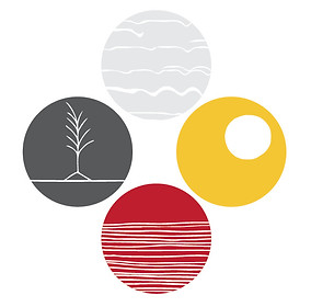
East
eastern doorway
West
doorway to lake
South
doorway to forest
GATHERING SPACES

Forum


Outdoor Cultural Space
PARTITION DESIGN/ SYMBOLISM

Home/ Family Unit
Thunderbird
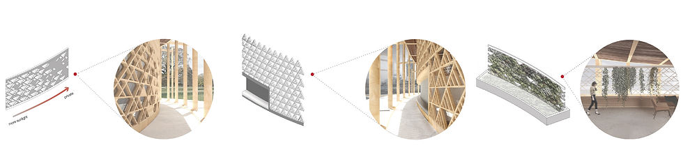
South Wall Partition
North Wall Partition
Green Wall Partition
HERB BASKET


Oak Handle
Cedar & Oak Lid
CNC cut / butt & keys joints
Oak & Birch Dowel and Knob
Cedar Storage
CNC cut/ butt joints